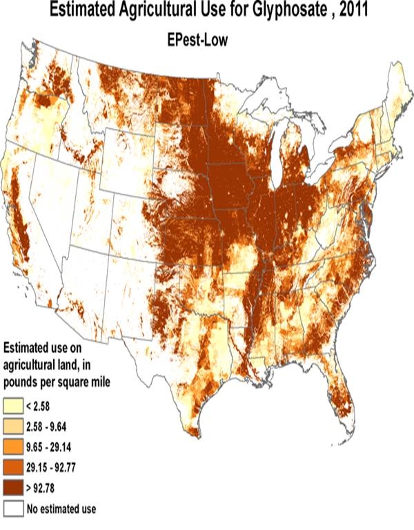
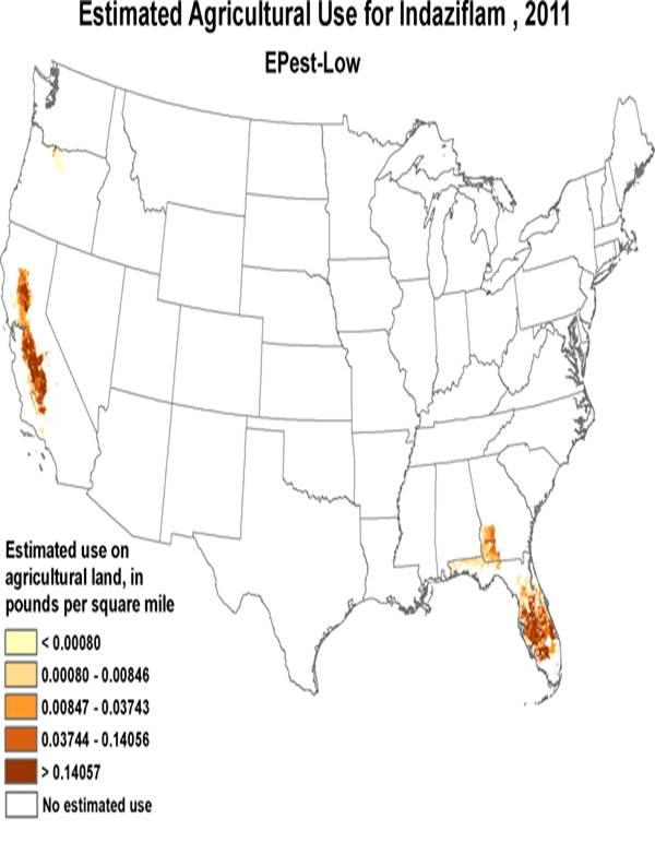
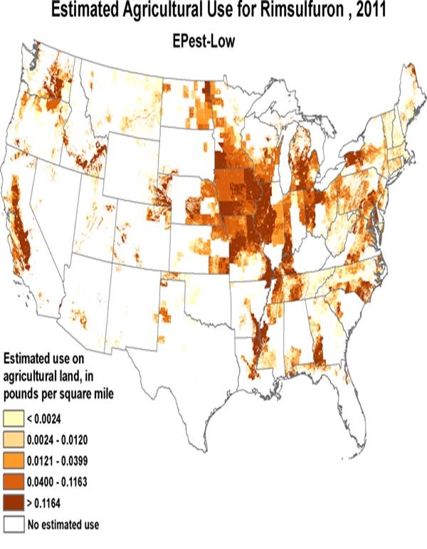
A quick post to share a really interesting website created by the USGS National National Water-Quality Assessment (NAWQA) Program. This site creates pesticide use maps showing geographic distribution of estimated (or actual use in California) of several dozen pesticides on agricultural lands for major crops.
http://water.usgs.gov/nawqa/pnsp/usage/maps/compound_listing.php
The website introduction states:
The pesticide-use maps provided on this web site show the geographic distribution of estimated use on agricultural land in the conterminous United States for numerous pesticides. Maps were created by allocating county-level use estimates to agricultural land within each county. A graph accompanies each map, which shows annual national use by major crop for the mapped pesticide for each year during the period. These pesticide use estimates are suitable for evaluating national and regional patterns and trends of annual pesticide use. The reliability of estimates, however, generally decreases with scale and these maps are not intended for detailed evaluations, such as within or between specific individual counties
Here's a paragraph lifted from the website describing the application and limitation for the data.
Pesticide use estimates from this study are suitable for making national, regional, and watershed assessments of annual pesticide use, however the reliability of estimates generally decreases with scale. For example, detailed interpretation of use intensity distribution within a county is not an appropriate use. Although county-level estimates were used to create the maps and are provided in the dataset, it is important to understand that surveyed pesticide-by-crop use was not available for all CRDs and, therefore, extrapolation methods were used to estimate pesticide use for some counties. Surveyed pesticide-by-crop use may not reflect all agricultural use on all crops grown. In addition, state-based restrictions on pesticide use were not incorporated into EPest-high or EPest-low estimates. EPest-low estimates are more likely to reflect these restrictions than EPest-high estimates. With these caveats in mind, including other details discussed in Thelin and Stone (2013), the maps, graphs, and associated county-level use data are critical data for water-quality models and provide a comprehensive graphical overview of the geographic distribution and trends in agricultural use in the conterminous United States.
I haven't fully explored this site yet, however, it is very functional and generates useful maps on the use patterns for several important pesticides. Interesting to see how widely some active ingredients are used (in many crops) compared to others that are more limited. Very cool data.
Take care,
Brad
X
Attached Images:


